GNSS signals in South Korea after the 2011 Tohoku Earthquake
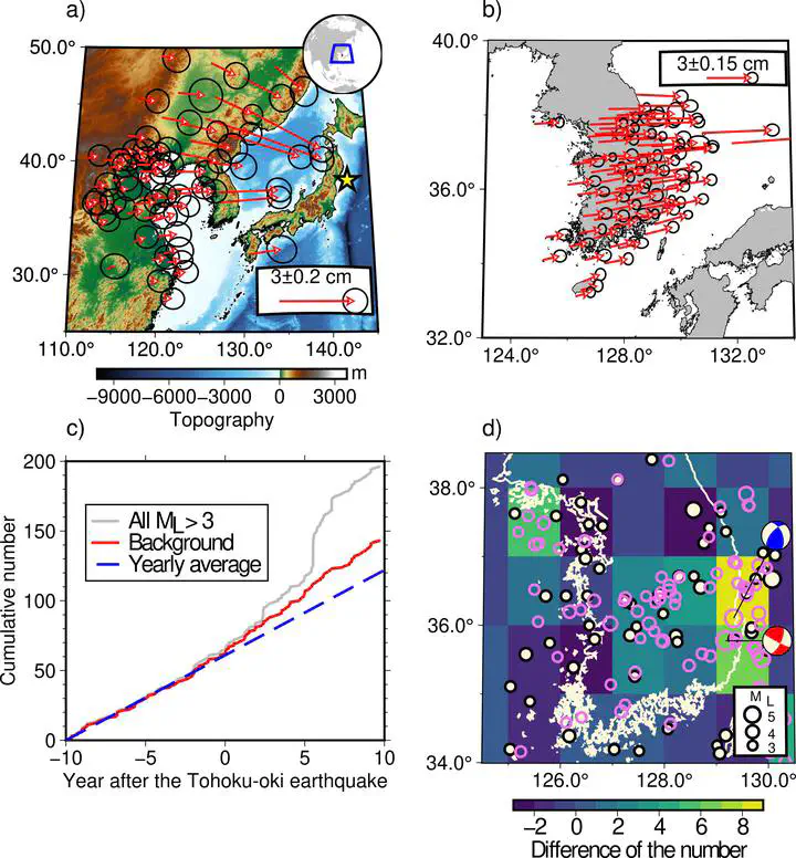 Changes induced in South Korea by the 2011 Tohoku earthquake
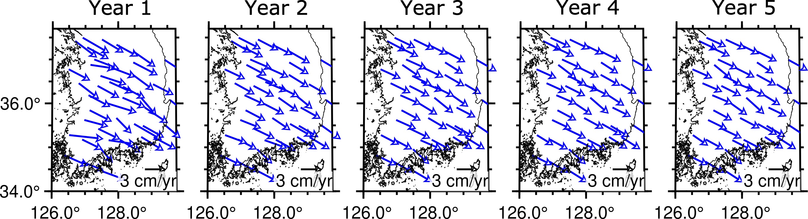
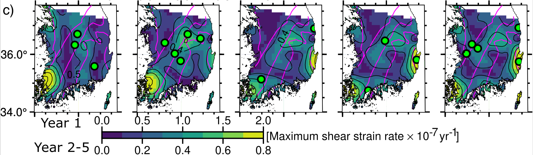
Our numerical models indicate that the asthenospheric
viscosity in this region is approximately 1019 Pa sec. However, deforma-
tion rates from the numerical models exhibit lower magnitudes and broader
scales of variation compared to those from GNSS data. The sensitivity of the
numerical modeling results suggests that small-scale variations in GNSS de-
formation rates might arise from lithospheric heterogeneity at a comparable
scale.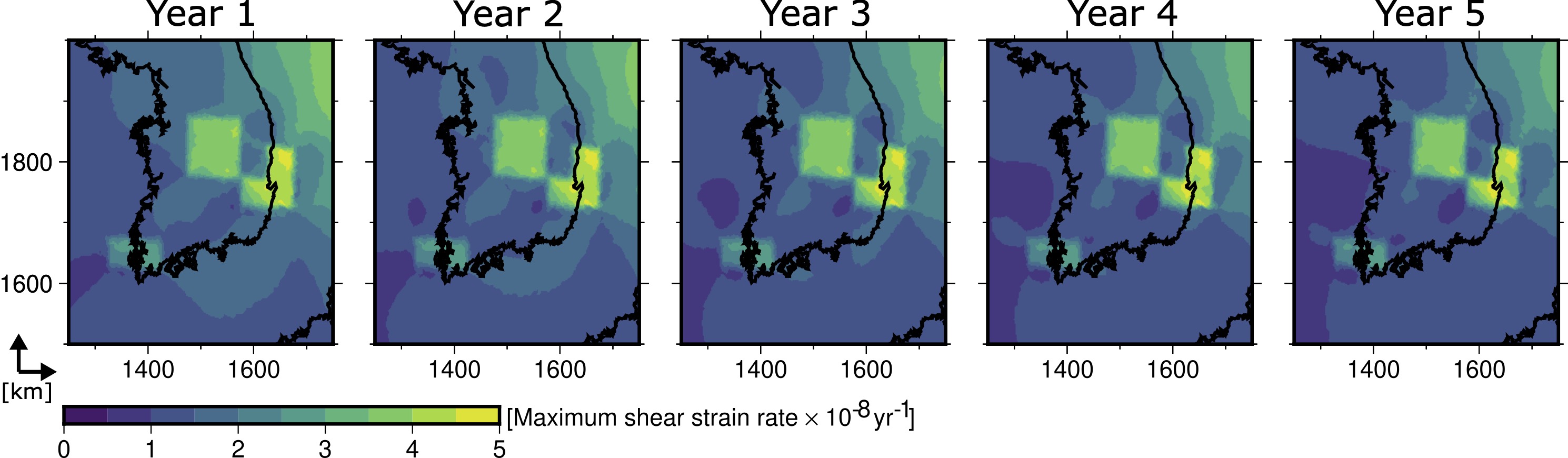
Eunseo Choi
Professor in Geophysics
My research interests include long- and short-term tectonic modeling and seismotectonics.